Sea Wind map basics
Become a Sea & Wind map power user in no time! The basic map buttons are very powerful, and easy to use. Here are some things to know:
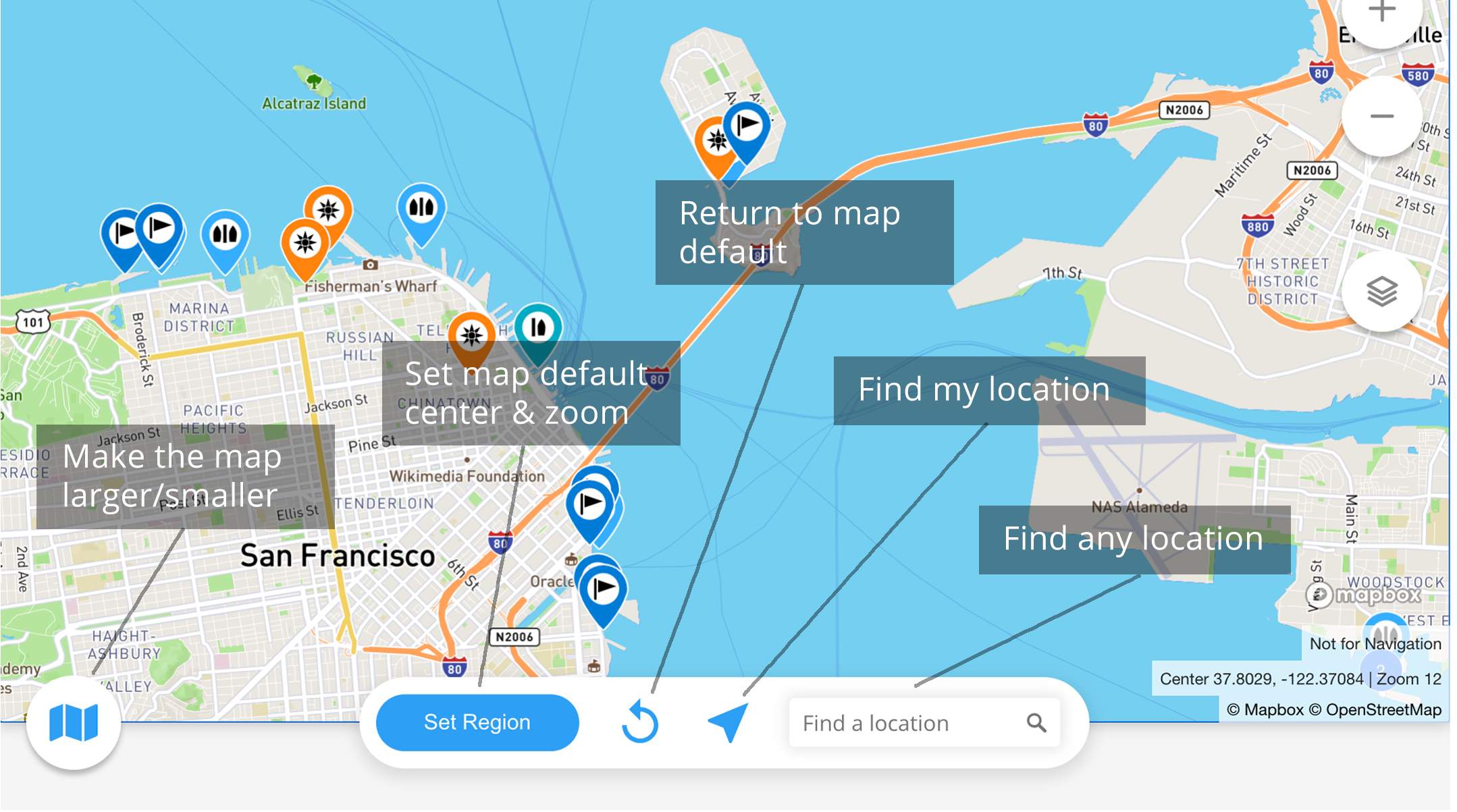
How do I use the Region functionality on the map?
- Use “Set Region” button to return to the map’s current location and zoom level
- Use the “Rewind” button to return to the default region.
- Find your location by using the direction arrow button.
- To use the “Find a Location” field, start typing the name of a location, then select from the list generated.
Hint: You can hover over the buttons to see a popup reminder of what they do.
Can I rely on Sea & Wind for navigation?
In a word, no! Sea & Wind is not a navigation app, and is not meant to replace charts or navigation tools that are necessary for safe navigation. You can however export Sea & Wind pins, etc. to your navigation software.
What units of measure are used in Sea & Wind?
Generally, we use feet, miles, miles per hour, and degrees Fahrenheit. Wind bearings specify the direction the wind blows from.
Latitude and longitude are specified as lat, lon (latitude first) and in decimal format. We will later allow users to set their own unit preferences.