NOAA Charts on Sea & Wind
NOAA Charts on Sea & Wind
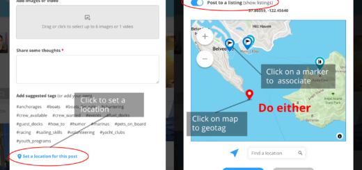
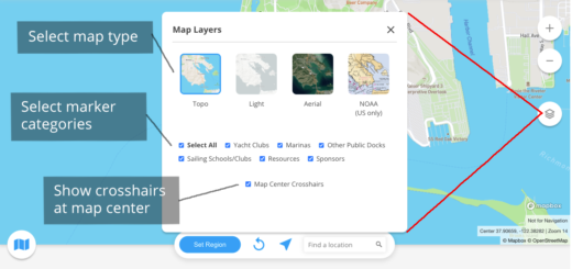
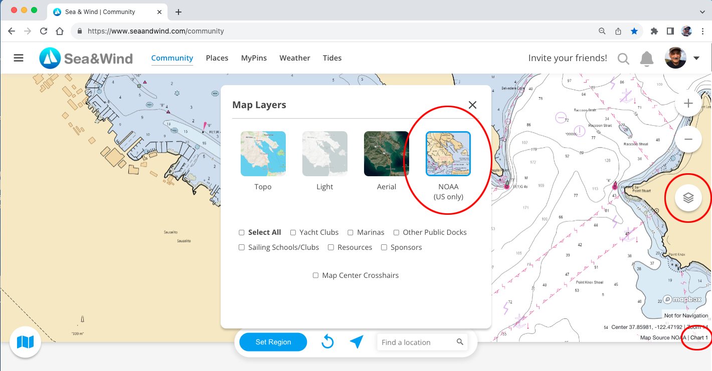
You can view NOAA Charts on Sea & Wind! Just click on the layers button, and select the layer of your choice, including NOAA charts. These are available for US locations only.
Want to know what the symbols on the NOAA charts stand for? The US Government’s Chart 1 publication has all the symbols and their meanings. The link is available on the lower right of the Sea & Wind map when the NOAA layer is selected, or here: https://nauticalcharts.noaa.gov/publications/us-chart-1.html